
High-Accuracy 3D Laser Scanning & Point Cloud Processing
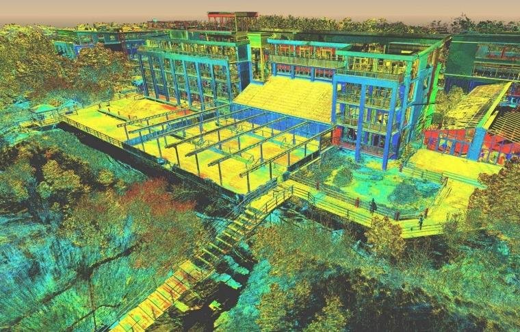
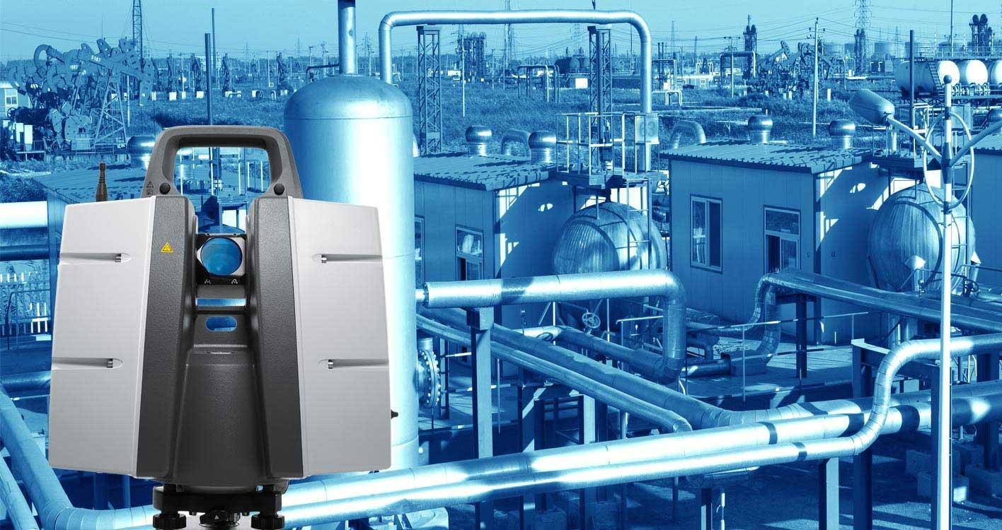
3D Laser Scanning & Point Cloud Processing is an advanced reality capture technology used to collect highly accurate spatial data of physical environments. Using LiDAR and terrestrial laser scanners, millions of data points are captured to create precise digital representations for engineering, construction, and infrastructure projects.
At HydroMarine Geophysics, we provide professional 3D laser scanning services and point cloud data processing using industry-leading tools and workflows. Our team ensures accurate data registration, noise filtering, and georeferencing to deliver reliable outputs for CAD, BIM, and GIS applications.
Our 3D Laser Scanning & Point Cloud Capabilities
We specialize in terrestrial laser scanning, LiDAR data processing, point cloud to CAD conversion, Scan to BIM modeling, and detailed 3D visualization. Our solutions help clients improve project accuracy, reduce rework, and enhance planning and design efficiency across multiple industries.
Start Your 3D Laser Scanning Project Today
High-Precision Reality Capture & Data Processing Solutions
We deliver high-quality 3D laser scanning and point cloud processing services tailored to your project requirements. From raw scan data to final deliverables, our workflow ensures accuracy, speed, and consistency.
Whether you need point cloud to CAD drawings, Scan to BIM models, or detailed 3D mapping, HydroMarine Geophysics provides reliable solutions that support better decision-making, asset management, and digital transformation.
Contact Us
HydroMarine Geophysics
We provide professional geophysical data processing and interpretation services worldwide. Contact us today to discuss your project requirements.
Address:
1 Albert Embankment,
LONDON, SE1 7XQ, UK
Phone:
+44 02045478801 / 07440309646
Email:
info@hydromarinegeophysics.com
contact@hydromarine.com
Our Project Outputs
3D Laser Scan Data
High-Density Point Cloud
Point Cloud Processing
Cleaned & Registered Data
Scan to CAD Drawings
Accurate 2D Plans & Sections
Scan to BIM Models
Intelligent 3D Models