
Advanced 3D Mapping & Digital Twin Data Processing
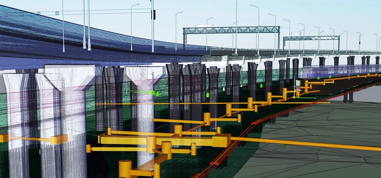
3D Mapping and Digital Twin Processing transforms spatial data into highly detailed digital representations of real-world environments. Using drone imagery, LiDAR data, and photogrammetry techniques, we create accurate 3D models and digital twins for infrastructure, construction, urban planning, and industrial applications.
At HydroMarine Geophysics, we deliver high-quality 3D mapping solutions by processing complex geospatial datasets with advanced software and workflows. Our team ensures precise data alignment, modeling, and visualization to support engineering design, asset management, and project monitoring.
Our 3D Mapping & Digital Twin Capabilities
We provide 3D model generation, digital twin creation, point cloud processing, mesh modeling, and BIM-ready outputs. Our solutions enable accurate visualization, improved planning, and efficient project lifecycle management.
Transform Your Projects with Digital Twin Technology
Accurate 3D Data for Smart Decision-Making
Our 3D mapping and digital twin processing services convert raw spatial data into intelligent digital assets. We help clients visualize real-world environments in a virtual space, improving project planning, monitoring, and analysis.
From infrastructure development to asset management, HydroMarine Geophysics delivers scalable and precise digital twin solutions that enhance efficiency, reduce risks, and support long-term project success.
Contact Us
HydroMarine Geophysics
We provide professional geophysical data processing and interpretation services worldwide. Contact us today to discuss your project requirements.
Address:
1 Albert Embankment,
London, SE1 7XQ, UK
Phone:
+44 02045478801 / 07440309646
Email:
info@hydromarinegeophysics.com
contact@hydromarine.com
Our Project Outputs
3D Digital Twin Models
Real-Time Virtual Assets
High-Resolution 3D Models
Accurate Surface Representation
Point Cloud Processing
Dense Spatial Data
BIM & Engineering Outputs
Ready for Design Integration